Project · Arlington, Maricopa County, Arizona
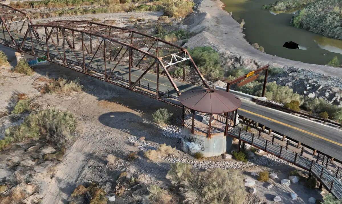
Gillespie Dam Bridge — a 1927 steel truss, recorded in three dimensions.
Multi-source reality capture of a National Register bridge over the Gila River, delivered as a measurable digital twin.
What we were documenting
The Gillespie Dam Bridge carries Old US 80 over the Gila River near Arlington, in Maricopa County. Opened in 1927 and listed on the National Register since 1981, it is one of only two surviving multi-span steel through-truss bridges in Arizona. In 1993 a Gila River flood destroyed Gillespie Dam outright; the bridge stayed up, with settlement at some piers and little else. A structure like this is difficult to document by conventional means, because the geometry that matters sits under the deck and out over the water. Axis Fields produced a complete 3D record of it, delivered as a digital twin an engineer or a heritage program can work from without returning to the site.
What the project required
Complete coverage of a long, thin steel structure, including close-range detail on connections and bearing seats that an aerial pass alone will not resolve. Positioning had to be independent of the aircraft's own estimate, and the record had to state what it covered and what it did not.
How Axis Fields approached it
Aerial photogrammetry was combined with terrestrial LiDAR so that the overall structure and the close-range detail on accessible portions were captured into a single georeferenced record. Positioning was GNSS-based and established independently, and the reconstruction was subjected to independent validation before delivery.
What was produced
- Textured 3D model of the full structure
- Classified and unclassified point clouds
- Orthomosaic imagery of the crossing and approaches
- A hosted digital twin and a flythrough
- Correction state, reference frame and an explicit statement of coverage
Validation figures are delivered with the data as a project record and are not published here.
How the information can be used
As a condition baseline for a structure that is still in service, as a heritage record of a listed bridge, and as measurable geometry for planning work around it — without closing the crossing to collect it.
Related
Services this project draws on.
Tell us what the data has to support.
That answer sets the tier, the approach and the price. Fifteen minutes on the phone is usually enough to settle it.