Home market · Buckeye & the West Valley
Drone mapping in Buckeye and the West Valley.
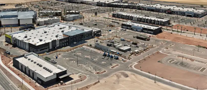
Axis Fields is based in Buckeye. The sites we map most often are the ones going up around us: retail pads, residential phases, industrial builds and the infrastructure that has to keep up with them.
Airspace most operators cannot schedule into
A large share of the West Valley sits inside Luke Air Force Base's controlled airspace, covering parts of Glendale, Peoria, El Mirage, Surprise, Litchfield Park and the corridor out toward Waddell and Citrus Park. There is no automated approval path in that airspace. An operator without prior arrangement is looking at a request that takes weeks, per site.
Axis Fields holds a standing FAA authorization for that area, valid through September 2028. In practice that means a West Valley site can be scheduled on the same timeline as one in open airspace, and a date we quote is a date we can actually fly.
What the West Valley needs mapped
This is one of the fastest-building corridors in Maricopa County, and most of what we capture here is mid-construction. Sites change weekly, and conditions under a slab are gone once it is poured unless somebody recorded them.
- Construction documentation on active commercial, industrial and residential builds
- Development and land parcels captured before ground is broken
- Infrastructure and asset documentation for owners and engineers
- Aerial imagery, video and 360 tours for leasing and marketing
Served from Buckeye
Buckeye, Goodyear, Litchfield Park, Avondale, Verrado, Surprise, Glendale, Peoria, El Mirage, Tolleson and the unincorporated county around them. Being local matters less for the drive than for the scheduling — an early window that gets weathered out can be reflown the next morning instead of the next week.
Tell us what the data has to support.
That answer sets the tier, the approach and the price. Fifteen minutes on the phone is usually enough to settle it.